 |
 |
 |
||
| walking through a war zone to get to the snow | putting the skis on... | our objective in the distance. we got as high up as possible on the right snow cone before continuing to the ridge |
 |
 |
 |
||
| right most snow cone is our route | karen skinning up through the trees | me skinning up through the beautiful forest |
 |
 |
 |
||
| loving the sun |
 |
 |
 |
||
| steep eh? |
 |
 |
 |
||
| hiding from the wind in the moat before the top of the ridge |
 |
 |
 |
||
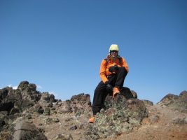
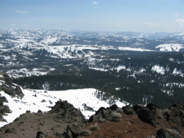
| can you tell i'm freezing? | nice view down the backside |
 |
 |
 |
||
| approaching the first rock step | karen negotiating a rock step on the ridge |
 |
 |
 |
||
| sweet, we actually get to do some climbing! |
 |
 |
 |
||
| the last bit to the summit. we didn't bother as the wind was actively trying to blow us off... | the slopes on the north side are tempting |
 |
") |
 |
||
| some snowmobile tracks in the snow (what's up with that?) |
 |
 |
 |
||
| karen skiing down.. not the best snow | but still nice |
 |
 |
 |
||
| close up of our turns and skin track |
 |
 |
 |
||
| last view of our peak | map at the trailhead |
 |
||
| approximate map |