Emerald Basin: President & Vice President attempt
Me and Nayden were excited about the excellent weather coming up
this weekend and made plans to do the President & Vice President
in a day by approaching it from Emerald Lake. I got up at 1am,
which is my all-time record, picked up Nayden and we were
on the edge of Calgary by 2:30am. The temperature was below
zero in the town of Field during the night, and we wanted
to get an early start to take advantage of the frozen glacier,
and to be down off of it early, because of the hot day that
was forecasted.
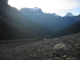
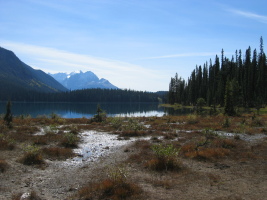
With headlamps on, we were hiking at 4:50am around the Emerald
Lake trail. Less than an hour later, we were in Emerald
Basin. Here's where we made a mistake... Sean's book
talks about following "the creek" until the snout of the
glacier, and the topo map (82N10) had a single creek running
down the correct valley. It was dark, and the terrain
didn't make a lot of sense, so we spent some time here
wondering what to do. Eventually we decided that since there
is only one creek on the map & the description, we should
just follow it. In the dark, it was really hard to
see other landmarks. This was a mistake and cost us over 2 hours,
because the big creek (including 2 waterfalls) follows
the valley on the West of the basin, toward Mt Carnarvon and
Mt Marpole. Needless to say, once the sun started coming
up and we had light, we realized we were in the wrong
valley and backtracked.
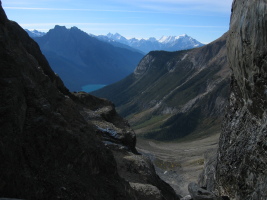
Eventually we started making our way up toward the glacier,
now with everything in sight. The gulley leading to
the glacier was much slower-going than we anticipated,
being loose and quite steep in places, and remaining snow/ice
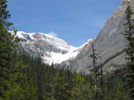
required us to take our crampons on and off. In the meantime,
the sun had come up, and was heating up the rock walls
surrounding us. On climber's left is the S ridge of
The President, which is an impressive overhanging wall...
in places directly above your head. There is water
seeping down these walls and as the sun was heating things up,
the threat of rockfall was increasing. I was worried about
rockfall the whole time, and as we witnessed a few rocks
doing just that
here, the choice was to turn back. We weren't sure an
alternative descent existed and the thought of coming back
down this gulley later in the day did not make us
feel safe, to say the least.
Perhaps had we not gotten off-route and wasted precious
time in the dark, this would be different.
There may be an alternate way, on the right side, away from the
creek gulley, where there is less objective hazard.
At least it looks that way from our pictures on the descent...
who knows.
It would be best to keep right from the start in that
case, as the rock was quite loose and climbing out of
the gulley did not look good once you're there. There
would still be a significant rockfall hazard in the
heat of an afternoon however, and I would not recommend
this route to anyone. On a cold day this maybe better,
but in the winter this must be an avalanche gulley.
We'll see whether we give it
another shot... it's tempting. However, the N Glacier
route on the other side looks much more aesthetic,
without the objective hazard, and seems to be a
better choice despite the longer approach.